
If you have not heard of the Arlington Loop, you are not alone. While the Loop has existed since the early 1990s, awareness of the Loop as an interconnected system of trails circumnavigating Arlington is not widespread. BikeArlington would like to change that.
A History
The Loop was created when the bridge connecting the Custis Trail to the Mt. Vernon Trail and Roosevelt Island was built in the late 1980s. Additionally, the final segment of the Four mile Run Trail, behind the Water Treatment Plant, was completed in the early 1990s. The original configuration of the Loop was closer to 17 miles, as the Four Mile Run Trail did not continue under I-395 at that time. To make the connection back to the trail, riders traveled through Shirlington, used the bike/pedestrian bridge over I-395, then followed streets in Alexandria to reconnect with the Four Mile Run Trail at the intersection of South and West Glebe Roads.
How To Ride The Loop
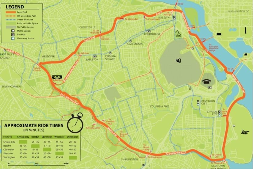
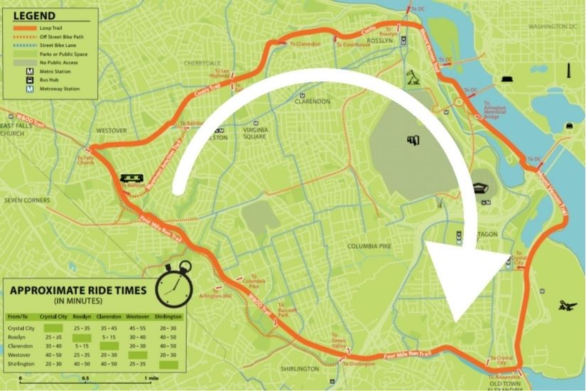
The Arlington Loop parallels two of the County’s most prominent natural features, the Potomac River and Four Mile Run, and a significant man-made feature, I-66. Much of the trail is relatively flat, as the Mt. Vernon Trail follows the Potomac River and the Four Mile Run. The W&OD Trials follow Four Mile Run. However, there is a significant uphill section on the Loop as the Custis Trail travels west, or counterclockwise, away from Rosslyn and the River. The remainder of the Custis Trails undulates as it travels through central Arlington. If you are considering a trip around the entire Loop, many people recommend traveling in a clockwise direction to avoid the uphill sections of the Custis Trail.
Use The Loop to Navigate Arlington
In addition to facilitating a great 16-mile bike ride, the Arlington Loop provides easy access for people walking and biking to destinations within and beyond Arlington. Numerous Arlington neighborhoods have direct access to the Loop, and most Arlington residents live within a mile of the trails of the Loop. The best part is that it is totally separated from cars, except for a few intersections, so you can ride in comfort.
Ride the Loop
Now that you know that the Arlington Loop exists, make a plan to go out and explore it. Whether you decide to ride the entire Loop or start exploring it in sections, this Arlington gem is sure to please and help you learn something new about our wonderful Arlington community.
About the Author